
Seeing Through the Mountain Citys "Lifeline": How 3D Geological Modeling Equips Chongqing with a "Wise Eye"?
2025-09-26Preface
The land beneath our feet is not a monolithic block. It is composed of complex rock layers, faults, and groundwater systems, akin to a city's "skeleton" and "blood vessels." In Chongqing, the "8D magical city," this complexity is particularly pronounced. Today, with cutting-edge 3D geological modeling technology, we can clearly see through this city's "lifeline" for the first time.
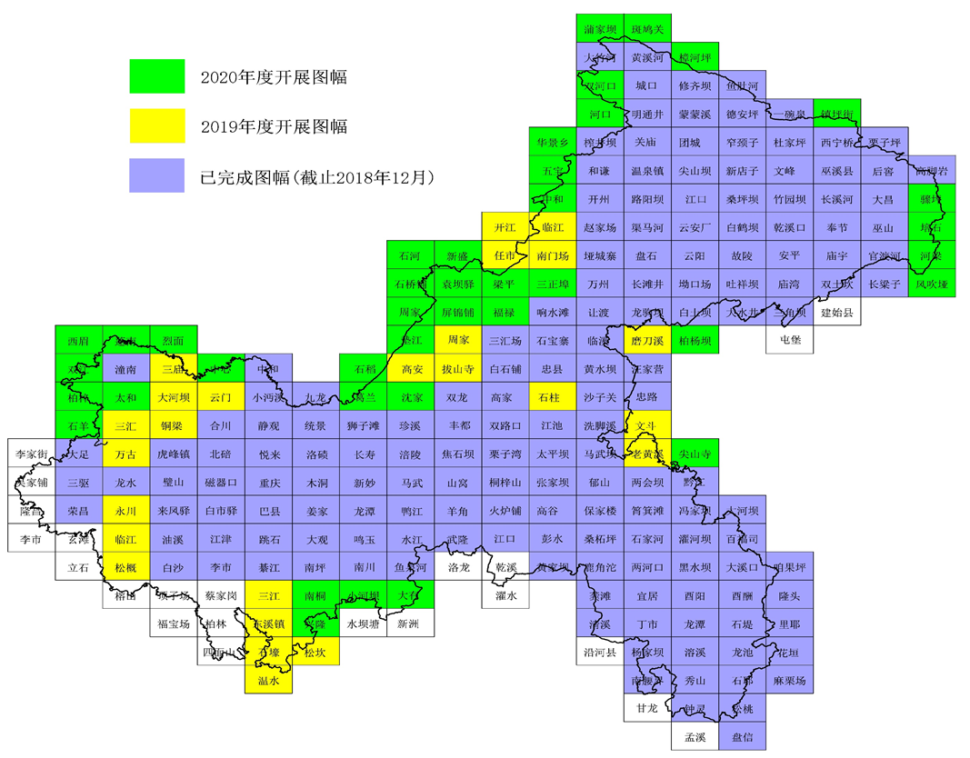
Recently, the Chongqing Geological Society published an article titled *A National First! Chongqing Achieves Full-Region 1:50,000 Regional Geological Map Integration and 3D Geological Modeling, Solidifying the Geological Foundation for Development*. The winning bidder for the project described in the article was the Chongqing Institute of Geology and Mineral Resources, which employed GridWorld's 3D geological modeling technology to make the mountainous city truly "clear at a glance."
From "Abstract Drawings" to "Transparent Strata"
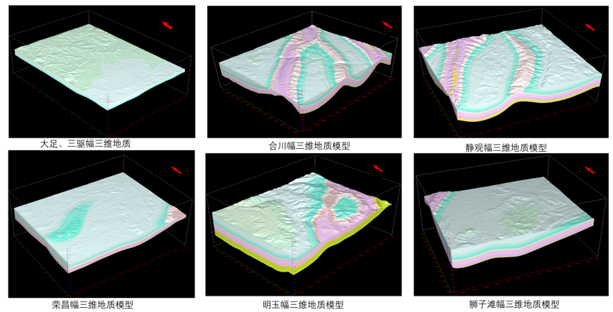
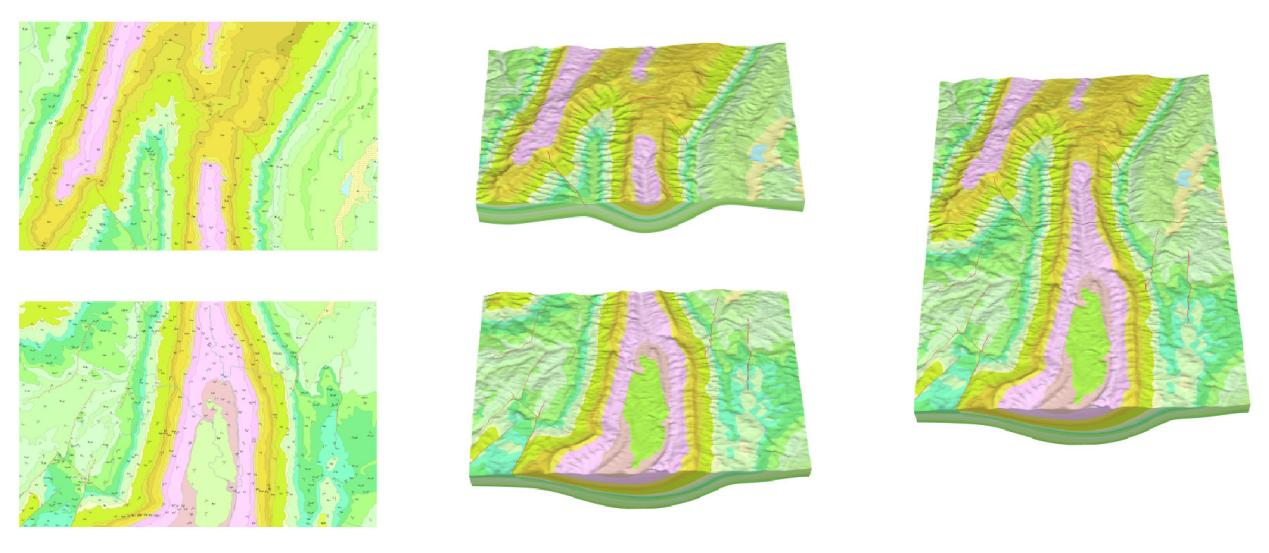
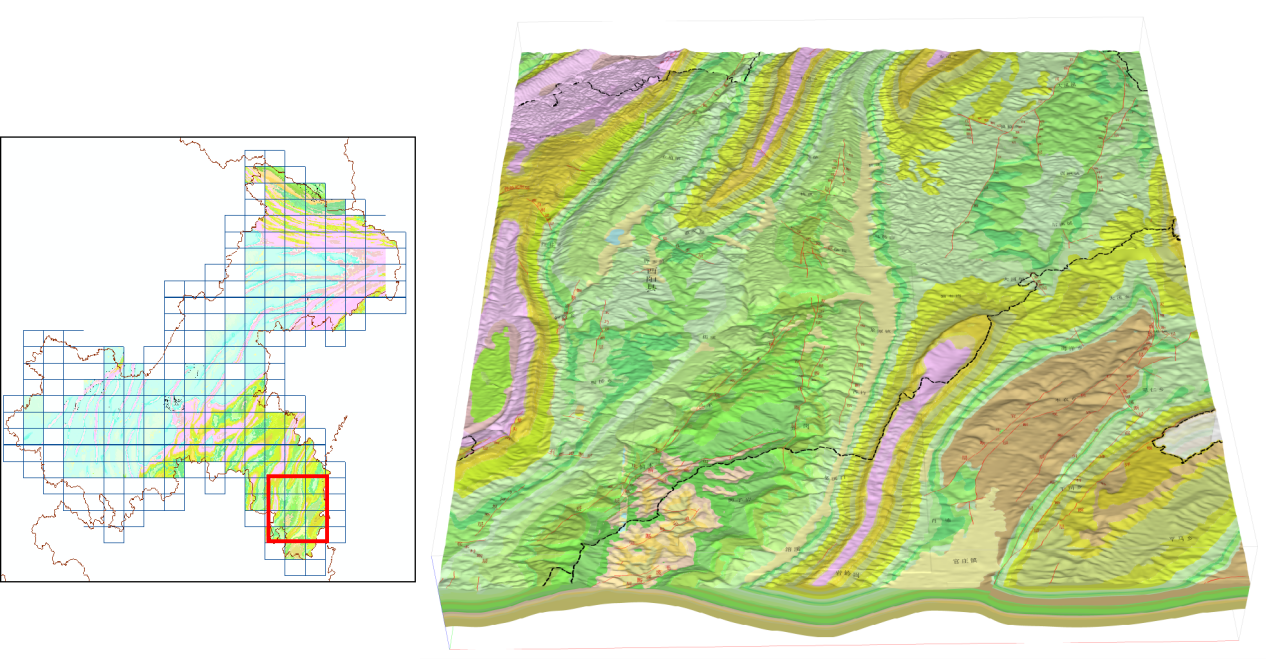
1. Understandable: Geological elements such as strata, faults, and groundwater are presented in 3D with different colors and forms, making them intuitively understandable even without a professional background.
2. Comprehensive: The model can be sectioned, rotated, and zoomed in on from any angle, revealing every detail of the underground space and completely moving beyond "flat thinking."
3. Accurate: Intelligent interpolation and modeling based on advanced algorithms can scientifically reconstruct geological structures even in data-sparse areas, significantly enhancing the model's accuracy and reliability.
This is more than just a map; it is an analyzable, simulatable "digital twin" of the underground space.
Safeguarding Our City's "Safety Underfoot"
The value of this technology extends far beyond visual impact. In a topographically unique city like Chongqing, it translates into tangible safety assurances and economic benefits.
1. "Precision Navigation" for Major Projects: Whether planning new rail transit lines or positioning bridge piers for river-crossing bridges, potential geological risks along the route can be accurately "seen through" using the model during the planning phase. This allows for avoiding fragile zones, selecting optimal paths, reducing engineering risks at the source, and saving construction costs.
2. "Early Warning" for Geological Disasters: Chongqing is prone to geological disasters such as landslides. The 3D model enables the 3D delineation of landslide body boundaries and simulates slope stability under conditions like rainfall, providing unprecedented scientific basis for disaster monitoring, warning, and comprehensive management.
3. "Reserving Space" for Urban Development: Underground space is a valuable resource. The model can clearly show the distribution of underground resources and assess suitability for future developments such as underground commercial streets, utility tunnels, and underground energy storage facilities, providing evidence-based support for the city's intensive and intelligent development.
Domestic Technology Illuminates the Dream of a "Transparent Earth"
When the underground world is no longer a mystery, the foundation we build for safe, resilient, and smart cities becomes more solid. This collaboration between GridWorld and the Chongqing Institute of Geology and Mineral Resources represents a powerful alliance between a top-tier research institution and a leading technology company, truly bringing the dream of a "Transparent Earth" into reality. It demonstrates that domestic software with independent intellectual property rights possesses the deep application capabilities in the geological field sufficient to support the modern geological work needs of a major city.
In the future, GridWorld will continue to uphold the philosophy of "driving geology's future with technology," delving deeper into core 3D geological modeling technologies and expanding application boundaries across multiple fields. At the same time, GridWorld looks forward to collaborating with more research institutes and geological exploration units to jointly open a new chapter in geological informatization development, contributing greater strength to promoting the intelligent, refined, and visual advancement of China's geological endeavors.