
Building a "Smart Shield" for Transparent Mines: The Five Core Engines of GridWorlds Geological Assurance System
2025-05-06In the wave of digital transformation, how can static models be made to "come alive," how can vast amounts of data be made to "speak," and even how can the future be simulated to aid decision-making? These are not only common questions across the industry but also the starting point of GridWorld's technological exploration.
Today, we unveil the five core capabilities that underpin GridWorld's breakthrough applications in smart mining, digital cities, and major engineering projects. Discover how we are building a new generation of intelligent geological assurance systems to construct a robust "smart shield" for mines.
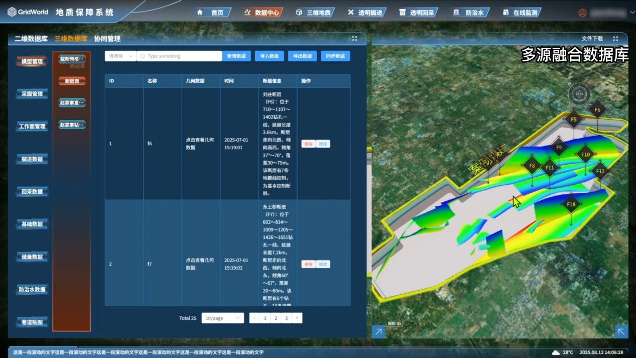
Converging the Geological "Panorama": Spatio-Temporal Database + Multi-Source Data Fusion
For geological assurance, data is the foundation. The spatio-temporal database we have built functions as a powerful "geological data hub," unifying, standardizing, and fusing massive amounts of multi-source, heterogeneous geological data, including drilling, geophysical surveys, measurements, excavation exposures, and microseismic monitoring.
It breaks down the barriers between various professional datasets, creating a continuously growing, never-lost "geological archive" for the mine. This makes hidden geological structures fully visible at the data level, providing a reliable data source for precise modeling and intelligent decision-making.
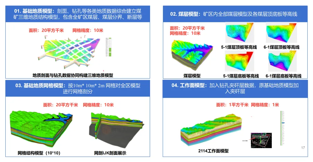
Constructing a Transparent "Geological Body": Multi-Modal Modeling + Simulation Digital Foundation
Based on comprehensive data, we employ multi-modal modeling technology to construct a high-precision, full-feature simulation digital foundation for mines. This includes not only high-precision 3D geological models but also seamless integration with surface geographic information and underground engineering facilities.
From this point forward, the relationship between geological structures and mine roadway spaces becomes clear at a glance. Managers can "penetrate" the strata to clearly visualize coal seam undulations and structural distributions, achieving a fundamental shift from "the blind men and the elephant" to a "transparent mine." This provides a realistic and reliable virtual environment for disaster warning and engineering planning.
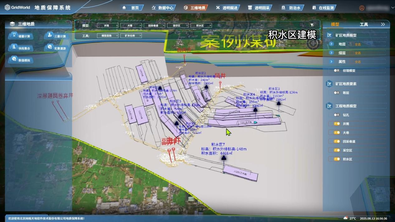
Endowing Excavation with "Adaptive Power": Dynamic Updates + Planning and Cutting
Geological conditions change dynamically. Our system features dynamic update capabilities, allowing the geological model to be revised and updated in real time based on the latest exposed geological information as tunneling and mining faces advance, ensuring the model remains synchronized with the actual site.
Based on the dynamically updated "transparent geological body," the system enables intelligent planning and cutting. Shearing machines can "know" geological changes ahead of time, automatically adjusting their cutting paths to effectively avoid geological anomaly zones such as faults. This facilitates unmanned, adaptive, safe, and efficient extraction, reducing geological risks at the source.
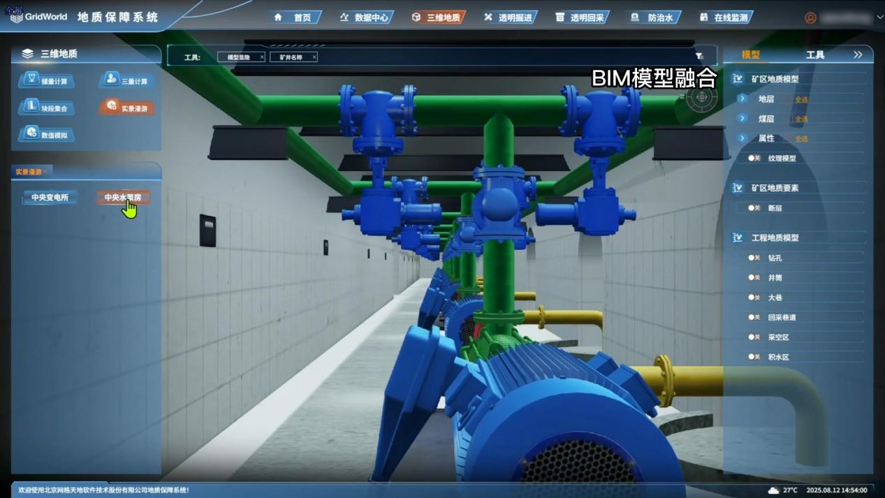
Creating a Unified Decision-Making "One Map": GIM+GIS/BIM Integrated Visualization
We integrate complex geological and engineering information through GIM+GIS/BIM integrated visualization technology, presenting it uniformly on the "Mine One Map" decision-making platform. From a satellite perspective thousands of meters above to the coal mining face hundreds of meters underground, information such as geological anomaly zones, hazard sources, equipment locations, and personnel distribution is seamlessly integrated and displayed in 3D.
This provides unprecedented global perspective and coordinated command capabilities for geological assurance work, making safety management decisions more intuitive and efficient.
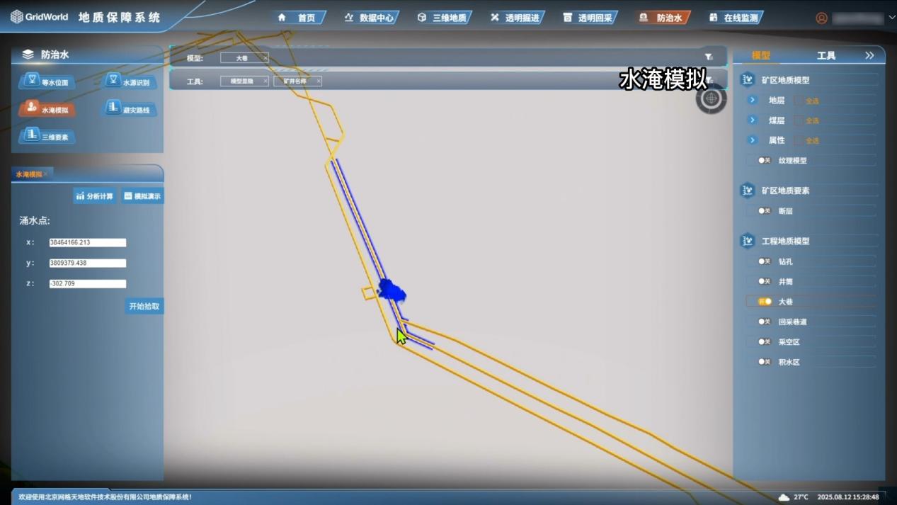
Installing a Disaster "Early Warning Radar": Rock Mechanics Numerical Simulation Analysis
This is key to proactive disaster prevention. Based on high-precision geological models, we conduct rock mechanics numerical simulation analysis to proactively simulate and predict the stress and deformation failure patterns of surrounding rock under mining influence, as well as the likelihood of disasters such as water inrushes and roof collapses.
This is equivalent to installing a "disaster early warning radar" for the mine, capable of accurately identifying hazardous areas before disasters occur. It provides a scientific basis for optimizing roadway support design, safe mining above confined aquifers, and more, truly achieving prevention before incidents happen.
The GridWorld Geological Assurance System, driven by the synergy of these five core engines, achieves "accurate perception, transparent visualization, dynamic warning, and intelligent control" of geological conditions. We are committed to transforming geology from an uncontrollable risk factor into a manageable, steerable element of safe production. With the power of technology, we safeguard the lives, property, and safety of mines, empowering the high-quality development of the mining industry.
GridWorld—making the secrets deep within the earth the cornerstone of safe and efficient extraction.